Showing posts with label Best of GPS. Show all posts

Google Maps Comes to Ford, OnStar via GPS


Ford and General Motors' OnStar unit will let drivers e-mail directions from Google Maps using their mobile phones to certain motor vehicles. Ford calls it a Send to Sync feature, which is available for its Ford, Lincoln and Mercury vehicles modeled 2010 or later. Drivers using the new OnStar eNav turn-by-turn navigation feature will search for directions on Google Maps, click the GPS option in the Send menu located in the upper right-hand corner of the map and send the directions to their GM cars.

Ford and General Motors' OnStar unit said June 8 drivers will be able to e-mail directions from Google Maps using their mobile phones to certain motor vehicles.
Ford's Sync Traffic, Directions and Information app, a program that lets drivers access voice-activated services through their mobile phones to communicate with their vehicles, is letting users access Google Maps.
The new Send to Sync feature lets drivers send destinations using Google Maps from their desktops, laptops or smartphones to their 2010 model and later Ford, Lincoln or Mercury vehicles.
The idea is to cut out the classic practice of searching for directions on Web services such as Google Maps and printing them out. 

Instead, drivers will transmit directions via the cloud to their Ford vehicle's Sync application when the Send to Sync capability launches later this month. Ford said it is offering the same feature for MapQuest, which will launch later this year.

Ford said the app uses a customer's mobile phone voice plan and the vehicle's integrated GPS receiver to shuttle driving directions or business searches, as well as horoscopes, news, movie listings and stock quotes. 

When drivers visit Google Maps on the Web from their computers and smartphones, they will be able to send directions to their Ford, Lincoln or Mercury vehicle via the GPS option in the Send menu located in the upper right-and corner of the map. 

Drivers will connect to Sync TDI, for car owners who have registered for TDI access here, using the Services voice command. When prompted, drivers can confirm the request to download the Google Maps direction to the vehicle.

"Printing paper directions from a Website is a relic in our digital age," Doug VanDagens, director of Ford Connected Services Solutions Organization, said in a statement. 

"With Send to Sync, you can map a destination at home, at work—wherever you have connectivity—and when you get to your car, it already knows where you want to go. It's convenient, and it eliminates the waste and distraction of paper maps, conserving resources while helping drivers keep their eyes on the road."

Ford is not the only company doing such directional information exchange over the cloud. 

General Motors, which is adding features for its Chevrolet Volt application that help users track their vehicles using Google Maps, said its OnStar roadside assistance service will now let users search for and send Google Maps directions to the navigation service in their vehicles.

Just as with the Ford Sync app, drivers using the new OnStar eNav turn-by-turn navigation feature will search for directions on Google Maps, click the GPS option in the Send menu located in the upper right-hand corner of the map and send the directions to their GM cars

The new OnStar feature will become available through Google Maps at the end of June. 

The app will work on all current turn-by-turn capable GM vehicles from the 2006 model year on and will integrate with the OnStar Destination Download to send destinations directly to the vehicle's navigation system. 

Google applauded adoption of Google Maps by GM and Ford, as a spokesperson said:


The new support for Google Maps means the app will gain more traction among the millions of drivers of Ford and GM cars and trucks. 

That's valuable action at a time when the search engine is seeking to not only maintain its massive Web services user base, but grow it in the face of Internet rivals Microsoft, Yahoo and Facebook. 

iPad 3G uses LCD frame as a giant 3G antenna

lcd frame ipad 3g antenna 2 536x402 iPad 3G uses LCD frame as a 
giant 3G antenna 
For those of you wondering how the iPad manages to lock onto AT&T (NYSE: T)’s wireless data network and GPS satellite signals despite its signal-blocking aluminum unibody casing, iFixIt’s new iPad 3G dissection sheds some light on just how Apple (NSDQ: AAPL) solves the “aluminum problem.” Turns out, the iPad 3G makes the most of its LCD frame by using it as a giant antenna. The black plastic insert near the top of the tablet also allows radio signals to pass through without being blocked by the aluminum shell, but that was already a given. Apple’s use of the LCD frame as an antenna is definitely more interesting.
lcd frame ipad 3g antenna 1 300x224 iPad 3G uses LCD frame as a 
giant 3G antenna
Aside from the obvious difference of the added 3G radio, the iPad 3G also boasts a GPS receiver. The iPad WiFi model does not have GPS functionality. What’s more, iFixIt’s iPad 3G teardown reveals that the tablet uses a GPS chipset that’s superior to the iPhone 3GS’s  GPS hardware. Gone is the 3GS’s Infineon (NYSE: IFX) Hammerhead II GPS chip, replaced by the iPad 3G’s Broadcom (NSDQ: BRCM) BCM4750UBG Single-Chip AGPS Solution. Chalk up a win for the iPad and Broadcom.
What’s most interesting with this teardown is that Apple is employing a fairly novel technique for making the most of the tight space within the iPad’s slim package. The iPad 3G has the same dimensions as its 3G-lacking sibling, but has to pack in more hardware. Rather than making more space for a dedicated radio antenna, Apple is using the LCD frame as a large antenna. Apple also used this technique in the new MacBook Pro, where the frame of the optical drive is used as a WiFi antenna. There’s also a radio antenna underneath the iPad’s black plastic insert.
So, the question is, does the reception from the LCD frame compare well with the iPhone 3G? If you have an iPad 3G and have noticed any differences in reception quality, let us know in the comments below!
More Information


credit: www.intomobile.com

MapQuest iPhone App Revamped To Include GPS Voice Navigation

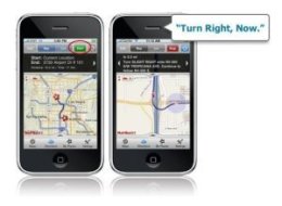
The MapQuest iPhone App has been given a facelift, and beginning today it now includes GPS voice navigation.
"MapQuest 4 for iPhone" is a free app that brings turn-by-turn navigation by voice to the iPhone. The Android smartphone has long had such capabilities and the iPhone is now officially in the voice GPS navigation game.
It is "basic voice guidance" only, Mashable notes, so while it tells you when to make turns and lets you know if you're off route, it won't pronounce every street name.
But it's a start, and again it is free to download.
MapQuest released its first iPhone App in June 2009 with extremely basic features to compete with the default Google Maps app on the iPhone.

Best 5 GPS systems (Continue)

1. Garmin Nuvi 660

The price tag is a little hefty, but if you can swing it, the Garmin Nuvi 660 delivers a solid-performing and versatile GPS device that offers navigation basics, tools for the world traveler, Bluetooth, and more. If the Nuvi 660 is too much for you, Garmin offers other models in the Nuvi series with the same great performance, so there's sure to be a model to suit your needs.

2. HP iPaq rx5900 Travel Companion

For the movers and shakers, the HP iPaq rx5900 Travel Companion delivers a sleek, all-in-one solution that can not only keep you on track during your travels but also with your schedule. This PDA-GPS combo is one of the sleekest we've seen to date.

3. Magellan Maestro 4250

The Magellan Maestro 4250 is one of the first portable navigation systems we've tested with a voice command feature. While the ability to operate the GPS device with the sound of your voice is cool, we're more impressed with the accuracy and solid performance of this mid-level system.

4. Mio C520 Navigation Receiver

The sleek Mio C520 is a good-value GPS device, packing in advanced navigation features, a large screen, and other extras for an affordable price. It's even sleek enough that we'd use it as a video player. Our only complaint is that we think you can get a slightly better experience and smoother performance from competing systems.

5. TomTom GO 720

Portable navigation systems are a dime a dozen these days, but the sleek TomTom GO 720 differentiates itself with a new Map Share community tool that gives you access to constant map updates and a useful safety option in case of an emergency.

credit:Bonnie Cha

Best 5 GPS systems

The Thomas Guide used to be the apex of car navigation, but GPS and digital-mapping technology have combined to make an evolutionary leap. These portable navigation systems can help you get from point A to point B with audible driving directions, color maps, points of interest, and much more. And while they were once a novelty tech toy for early adopters and gadget hounds, they've gained in popularity and the market is now flooded with them. To help you in your buying decision, we've selected our Top 5 picks for in-car GPS navigation systems. We will frequently update this list as we review new GPS devices, so check back often.
1. Garmin Nuvi 660
2. HP iPaq rx5900 Travel Companion
3. Magellan Maestro 4250
4. Mio C520 Navigation Receiver
5. TomTom GO 720


Copyright 2008-2012 GPS News and GIS News | Back To :Gps News | Bankruptcy Lawyer Help | Fixed Gear Bike Store | Shoes Shop | PreOrder Thai Suit Shop for Men